August 20, 2026 at 12:00 p.m.
Firefighting operations continue to successfully hold the Hagen Fire within established containment lines, allowing officials to safely reduce portions of the evacuation levels around the fire.
However, conditions can change quickly, due to fire activity or the urgent need to provide fire crews the space needed to work safely. Travelers are encouraged to avoid unnecessary travel through the area, slow down and watch for fire crews, heavy equipment and trucks entering and exiting the highway.
County officials continue to work closely with the fire incident management team to evaluate fire activity, weather conditions, control lines and risks to homes and communities. As conditions improve, officials are actively evaluating whether evacuation levels can be safely reduced. Any changes will be based on conditions on the ground and the ability of fire personnel and emergency responders to safely protect residents and provide access to affected areas.
Members of the public are advised that active firefighting efforts continue, and all Forest Service road closures remain strictly in effect.
Residents should continue to follow current evacuation guidance and remain prepared for changes. Updates will be provided as conditions support changes to evacuation levels.
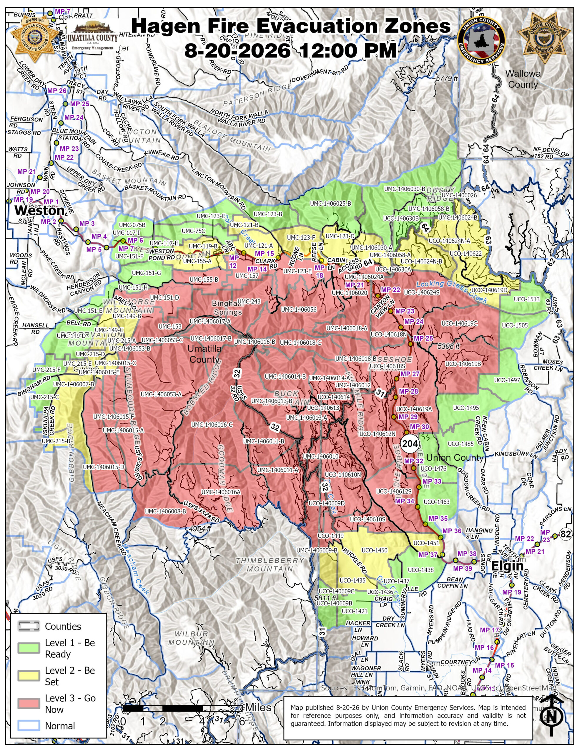
Effective immediately the following evacuation levels have been REDUCED in these areas of Umatilla County, Union County and Confederated Tribes of the Umatilla Indian Reservation :
UMATILLA COUNTY and CTUIR
UMATILLA COUNTY
REDUCED FROM LEVEL 3 TO
LEVEL 2 – BE SET
Evacuation Zones:
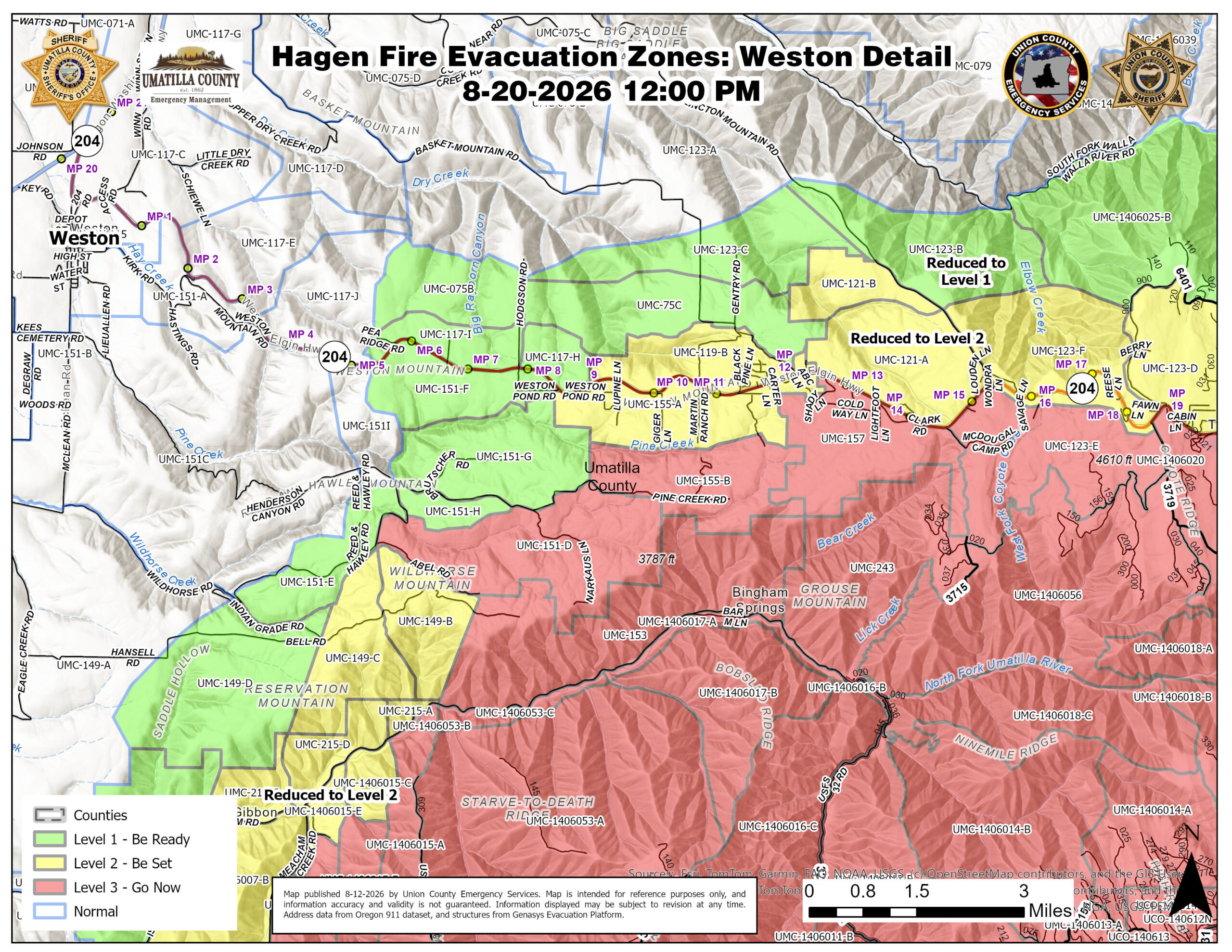
UMC-119-B
UMC-121-A
UMC-123-F
UMC-123-D
UMC-155-A
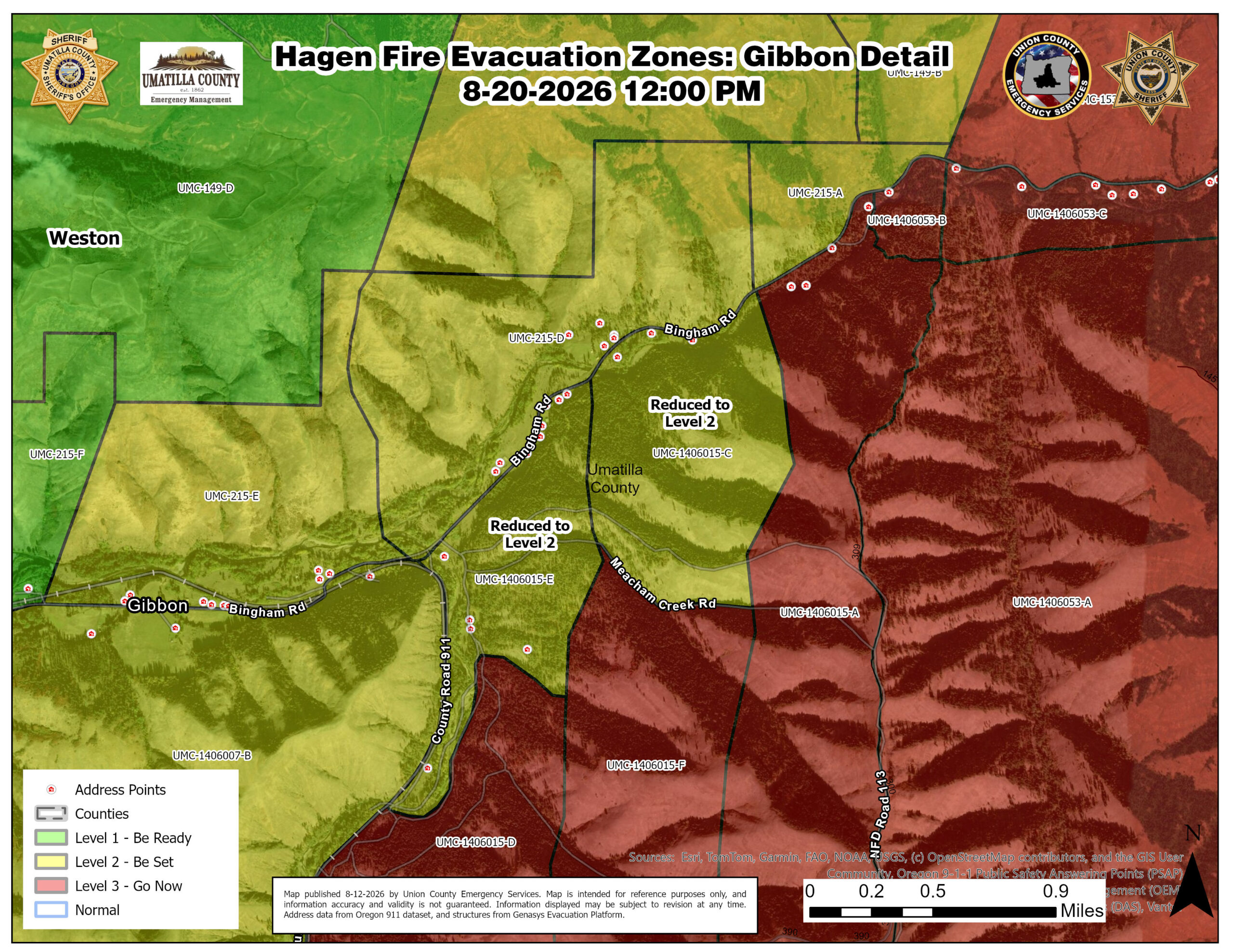
UMC-1406015-E
UMC-1406015-C
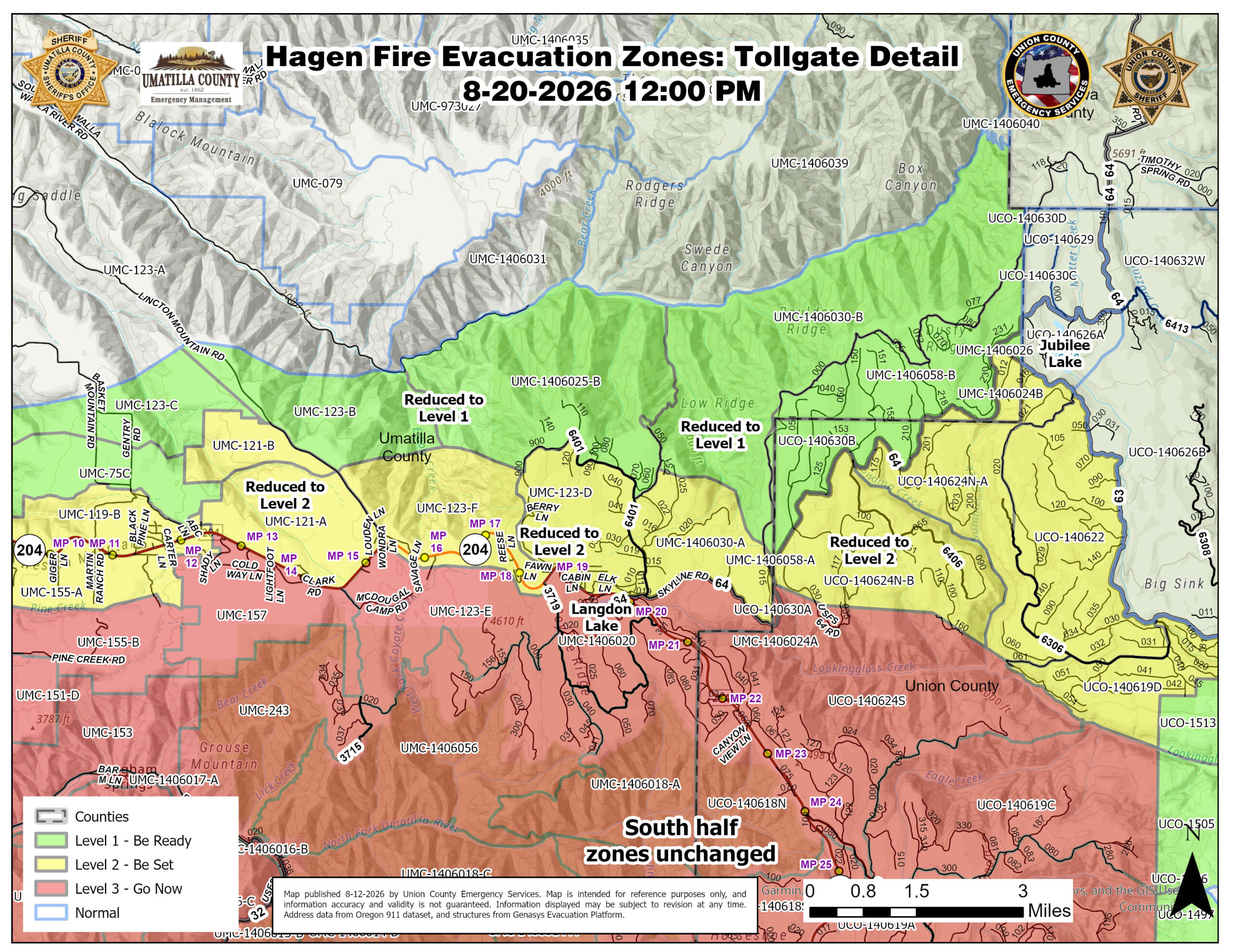
REDUCED AREAS: LEVEL 2 – BE SET includes the areas north of Highway 204 starting at ABC lane and continuing east to the Union County boundary.
______________________________
UMATILLA COUNTY
REDUCED FROM LEVEL 2 TO
LEVEL 1 (BE READY)
Evacuation Zones:
UMC-125-C
UMC-75-C
UMC-1406025-B
UMC-1406020-B
UMC-1406058-B
UMC-1406024-B
REDUCED AREAS: LEVEL 1 (BE READY) includes the upper section of Lincton Mountain Road (approximately 1 mile north of Highway 204) continuing east to Union County boundary, and the area of Bingham Road and Meacham Creek, just wouth of Bingham Rd on both sides of Meacham Creek.
Fire conditions can change rapidly and unpredictably. Do not wait for an official evacuation order if you feel unsafe or see immediate danger. Leave without delay.
All other previously issued levels in Umatilla County remain the same.
____________________________________
UNION COUNTY
UNION COUNTY
REDUCED FROM LEVEL 3 TO
LEVEL 2 – BE SET
Evacuation Zones:
UCO – 140624N-B
REDUCED AREA: LEVEL 2 – BE SET includes the area south of Swamp Creek and the USFS 64 Road, and northeast of the USFS 6400-030 spur road.
____________________________________
UNION COUNTY
REDUCED FROM LEVEL 2 TO
LEVEL 1 (BE READY)
Evacuation Zones:
UCO – 1506030-B
REDUCED AREA: LEVEL 1 (BE READY) includes the area within Union County that is northwest of the USFS 64/Skyline Road
All other previously issued levels in Union County remain the same.
Fire conditions can change rapidly and unpredictably. Do not wait for an official evacuation order if you feel unsafe or see immediate danger. Leave without delay.
Current Evacuation Map Genasys
Current Evacuation Map Raptor
Umatilla County Emergency Advisory Information:
Union County Emergency Services:
Sign-up for emergency alerts: www.oralert.gov
Continue to follow official fire updates at Paradise, Hagen and Horse Ridge Fire Information