(Umatilla County, Union County, Confederated Tribes of the Umatilla Indian Reservation)
August 25, 2026 at 12:00 p.m.
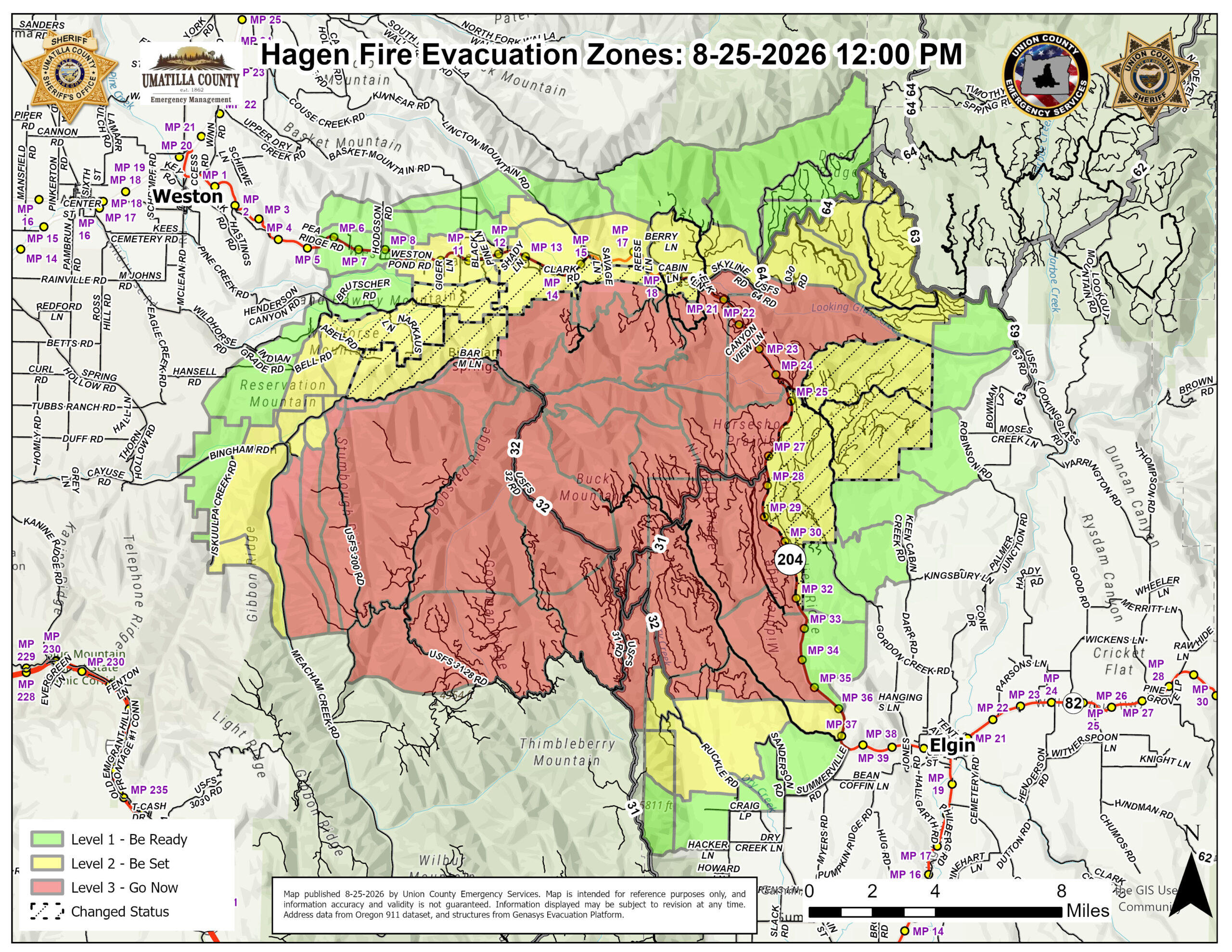
Firefighting operations continue to strengthen containment features and successfully hold the Hagen Fire within primary control lines, allowing emergency officials to safely reduce evacuation levels in select areas once again.
Effective immediately the following evacuation levels have been REDUCED in these areas of Umatilla County, Union County and the Confederated Tribes of the Umatilla Indian Reservation (CTUIR):
UMATILLA COUNTY and Confederated Tribes of the Umatilla Indian Reservation (CTUIR)
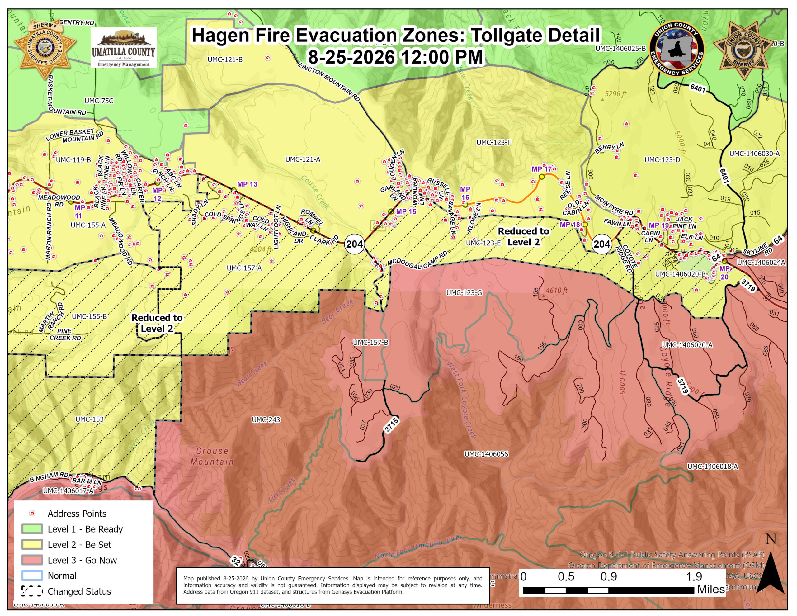
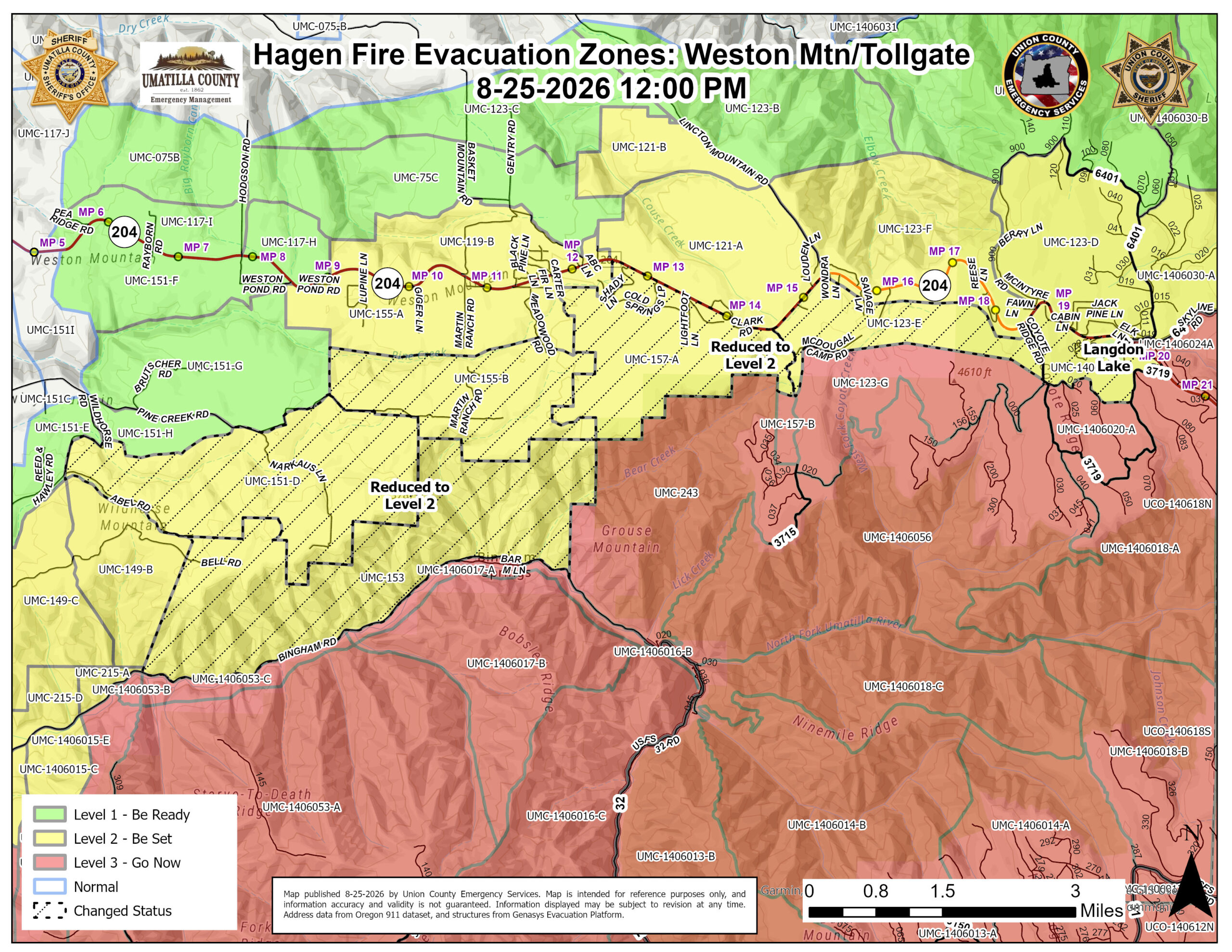
REDUCED FROM LEVEL 3 TO LEVEL 2 – BE SET
Evacuation Zones:
UMC-151-D
UMC-153
UMC-155-B
UMC-157-A
UMC-123E
UMC-1406020-B
REDUCED FROM LEVEL 3 TO LEVEL 2 – BE SET:
Includes north of Bingham Road west of Grouse Mountain, including Narkaus Lane, Pine Creek Road, and Martin Ranch Road. Also the area immediately south of Highway 204 including all of Shady Lane, Cold Springs Loop, Lightfoot Lane, Clark Road, McDougal Camp Road, Lakeshore Drive, and the area immediately surrounding Langdon Lake.
____________________________________
UNION COUNTY
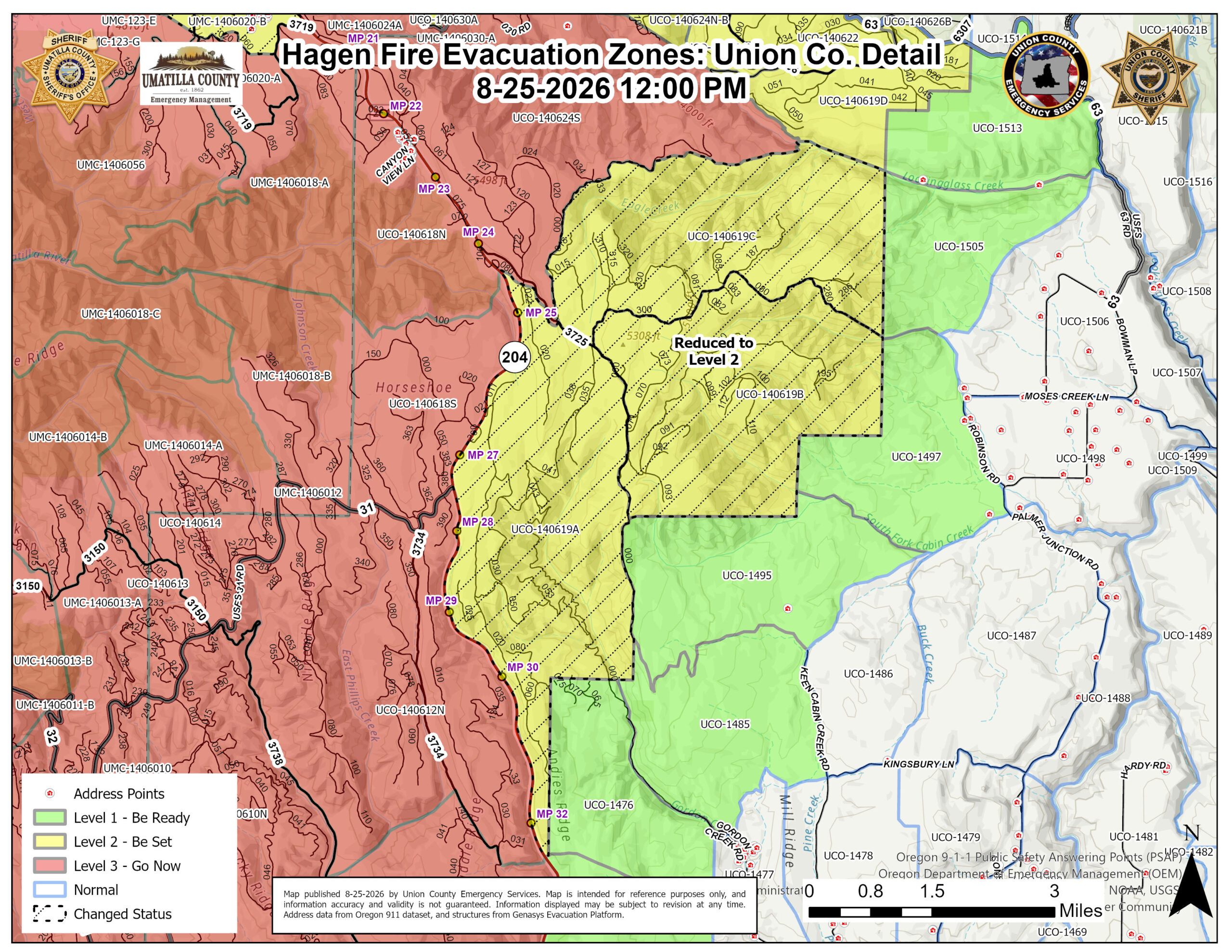
REDUCED FROM LEVEL 3 TO LEVEL 2 – BE SET
Evacuation Zones:
UCO – 140619A
UCO – 140619B
UCO – 140619C
REDUCED FROM LEVEL 3 TO LEVEL 2 – BE SET includes National Forest lands south of the 3701 Road and east of Highway 204. Important note: This area remains under administrative closure at this time.
____________________________________
All other areas not mentioned remain in their prior status, which was last updated on August 20th, 2026.
While progress is being made, conditions can change rapidly based on fire activity and operational safety needs. Members of the public are advised to remain alert and keep the following safety protocols in mind:
- Remain Diligent:Residents should continue to follow current evacuation guidance and remained prepared for changes.
- Avoid Unnecessary Travel:Drivers in the area are urged to slow down, stay vigilant, and watch for fire crews, heavy equipment, and trucks entering and exiting the highway.
- Respect Closures:All U.S. Forest Service road closures remain strictly in effect.
County officials are working in close coordination with the fire incident management team to continuously evaluate fire activity, weather forecasts, control lines, and risks to local communities. Official updates regarding further adjustments to evacuation levels will be provided as conditions support changes.
Current Evacuation Map Genasys
Current Evacuation Map Raptor
Umatilla County Emergency Advisory Information:
Union County Emergency Services:
Sign-up for emergency alerts: www.oralert.gov
USFS Road Closures
Continue to follow official fire updates at Paradise, Hagen and Horse Ridge Fire Information