| Name | Last modified | Size | Description | |
|---|---|---|---|---|
| Parent Directory | - | |||
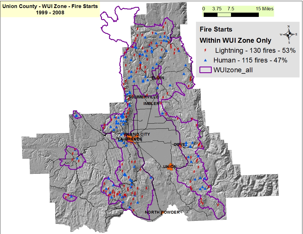
| firepts_within_WUIZone_only.jpg | 2015-04-28 09:10 | 533K | ||
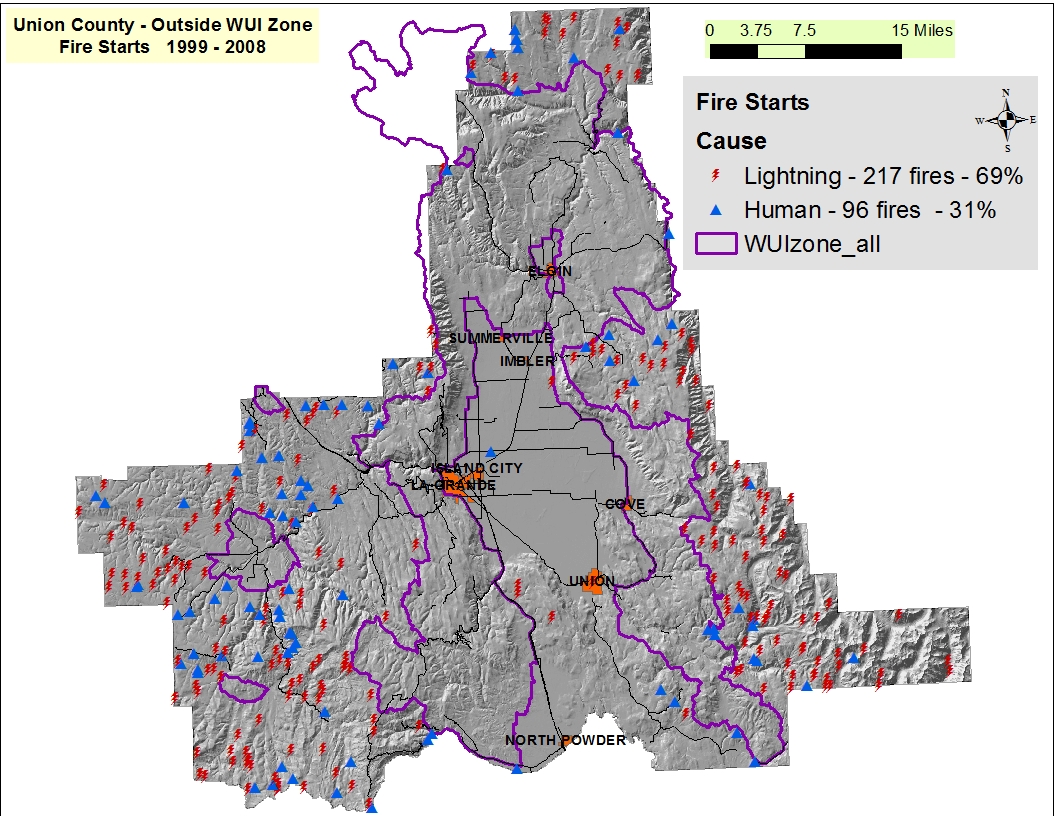
| firepts_Outside_WUIZone.jpg | 2015-04-28 09:23 | 550K | ||
| Tri_county_starts.jpg | 2015-04-20 12:53 | 704K | ||
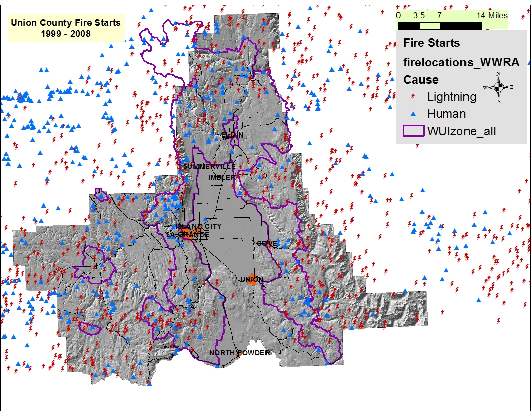
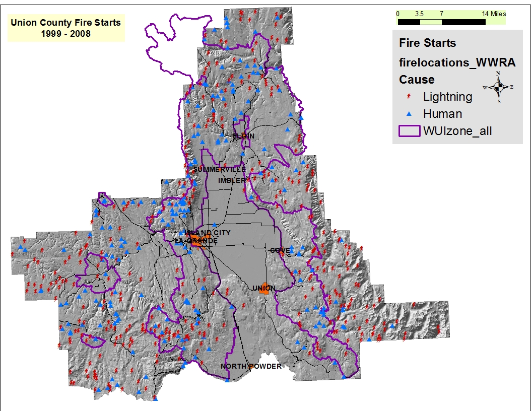
| OR_Union_cty_fire_starts_points.jpg | 2015-04-20 12:40 | 538K | ||
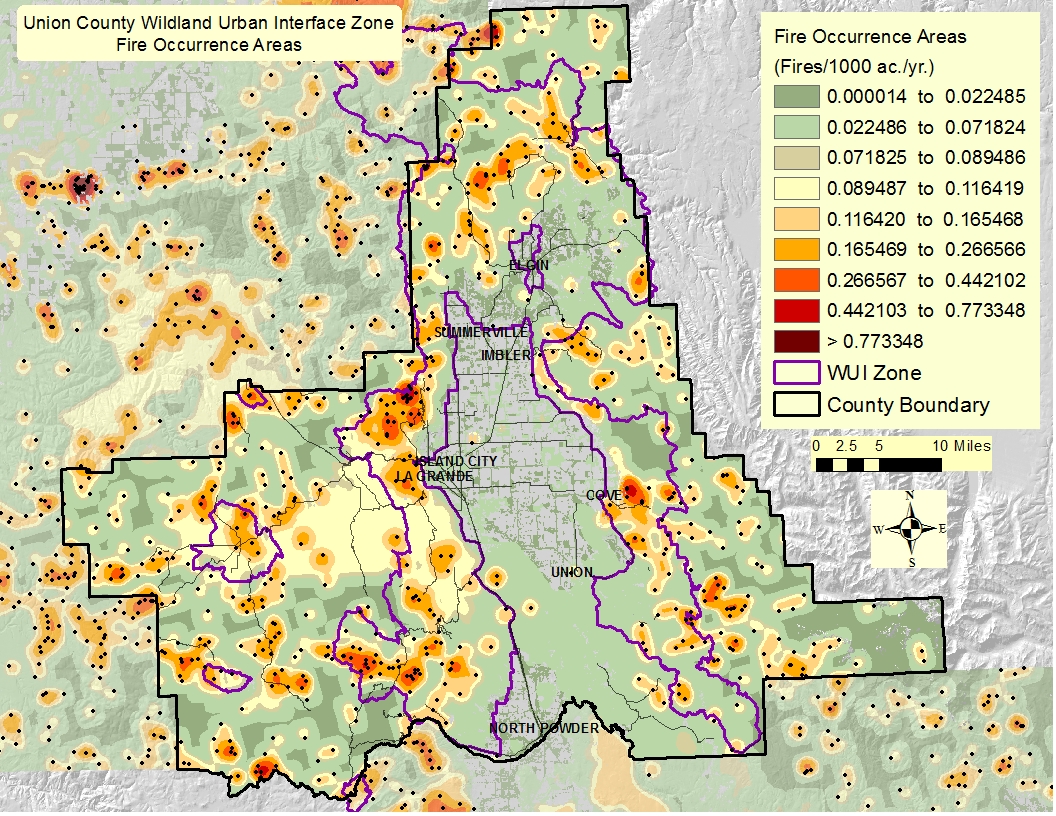
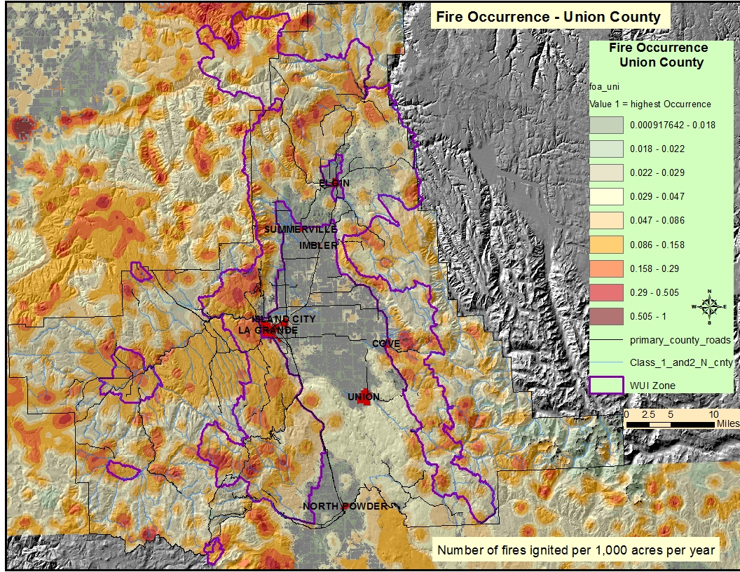
| OR_Union_cty_FireOcc_Areas.jpg | 2015-06-25 14:25 | 950K | ||
| Largefire_20miles_hillshade.jpg | 2015-06-18 11:03 | 924K | ||
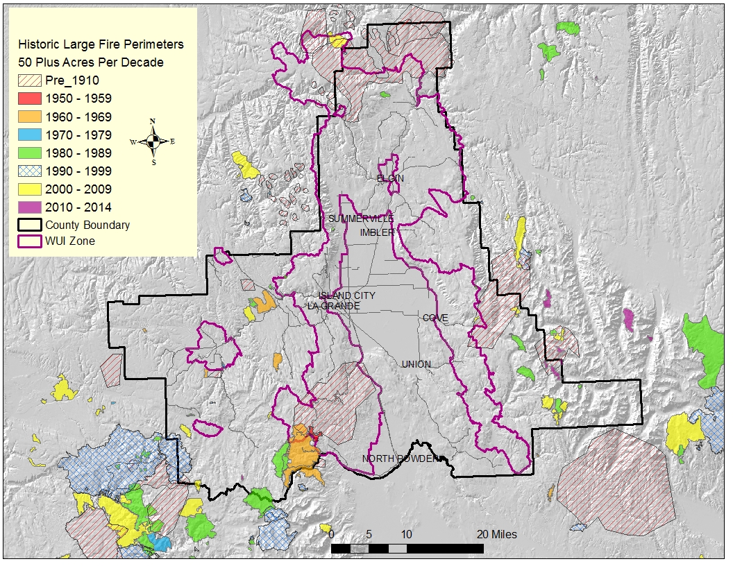
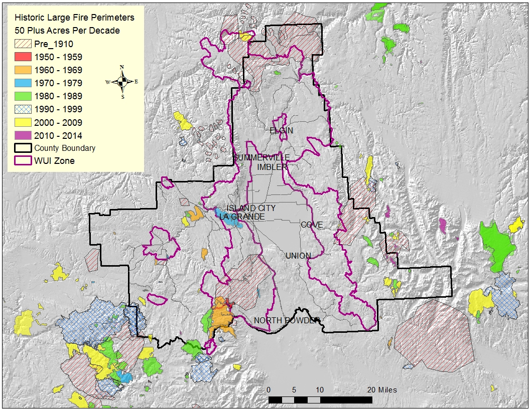
| Large_fires_50_acres_plus.jpg | 2015-06-22 09:43 | 893K | ||
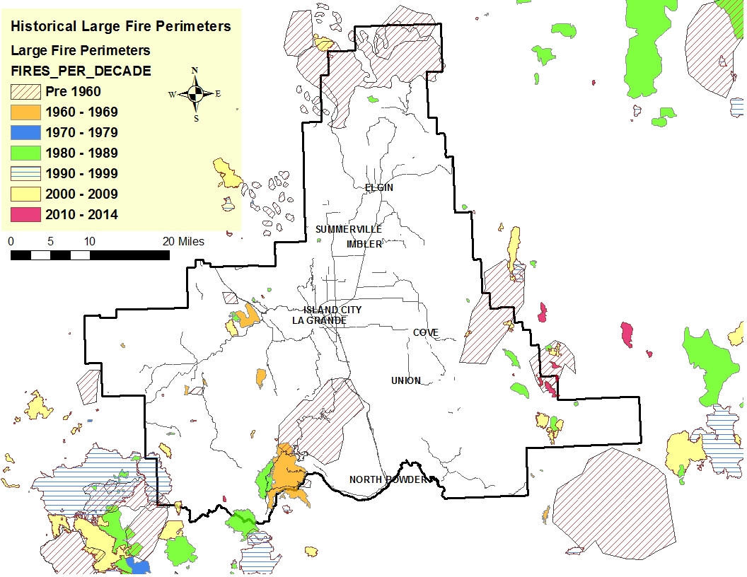
| Large_fires.jpg | 2015-06-12 09:16 | 473K | ||
| Large_fire_Hillshade.jpg | 2015-06-18 10:05 | 913K | ||
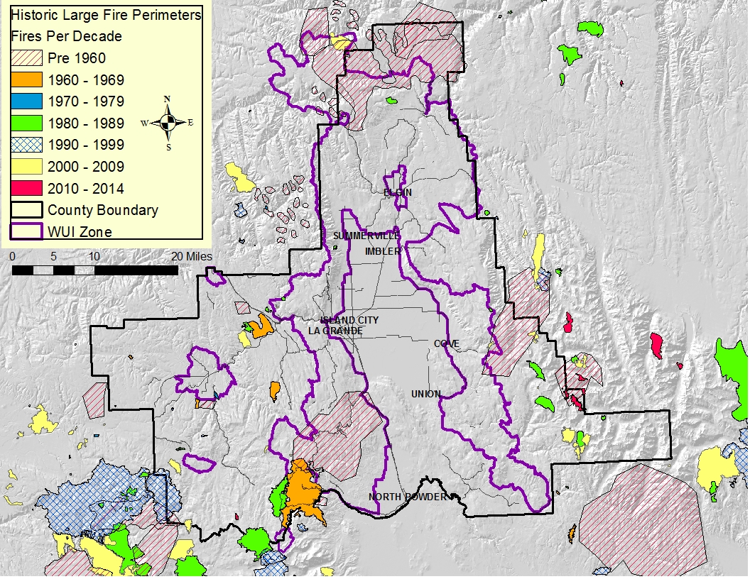
| LargeFires_1960_to_present_ALLagencies.jpg | 2015-07-17 10:14 | 868K | ||
| Historic_Large_fires.jpg | 2015-06-12 09:06 | 473K | ||
| Firepts_surrounding_laGrande.jpg | 2015-04-20 12:46 | 737K | ||
| FOA_withAnthLKS_streams.jpg | 2015-04-28 11:28 | 1.1M | ||
| CWS_Fire Regime NWarea.jpg | 2015-06-11 09:41 | 12K | ||
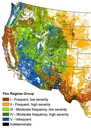
| CWS_Fire Regime Map.jpg | 2015-06-11 09:40 | 75K | ||
| ALL_LargeFires_RoosterPK.jpg | 2015-06-23 11:16 | 922K | ||